“With age, comes wisdom. With travel, comes understanding.”
Utah
Snow Canyon State Park
This state park features a canyon carved from the red and white Navajo sandstone in the Red Mountains. Snow Canyon State Park is a 7,400-acre scenic park quietly tucked amid lava flows and soaring sandstone cliffs in a strikingly colorful and fragile desert environment.
Other geological features of the state park include extinct cinder cones, lava tubes, and sand dunes.
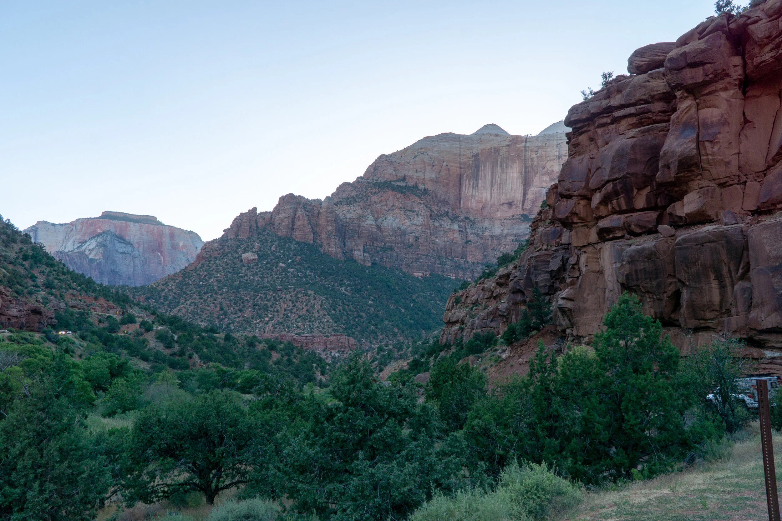
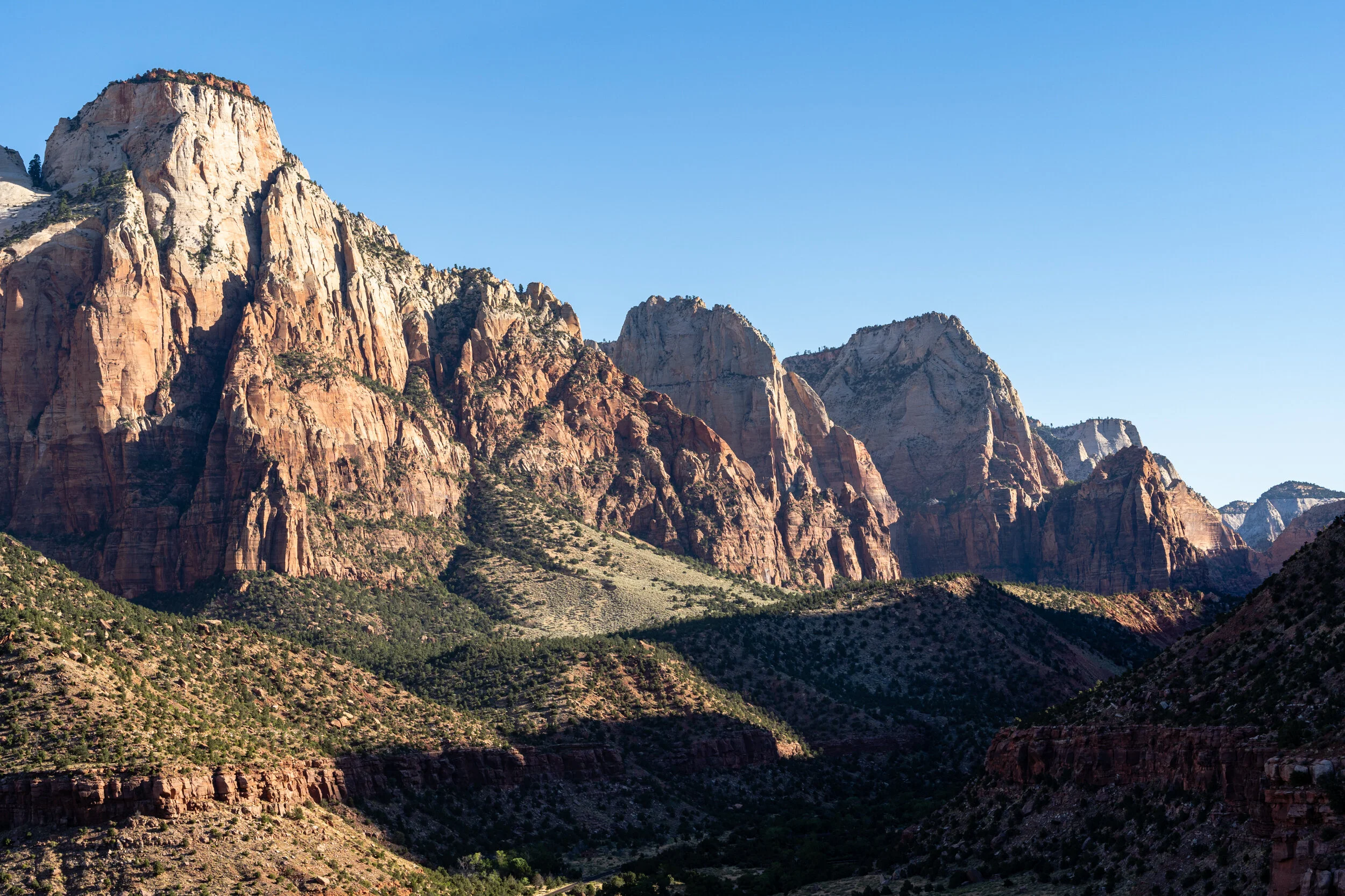
Zion National Park
Located in southern Utah near the city of Springdale. The highlight of Zion National Park is an expansive canyon. Averaging 2,000 feet deep, Zion Canyon offers hiking opportunities along its floor in the 20 to 30 foot wide area known as The Narrows and the challenging area known as The Subway. Swimming is also permitted in this area of the Virgin River.
Bryce Canyon National Park
Bryce Canyon National Park, a sprawling reserve is known for crimson-colored hoodoos, which are spire-shaped rock formations. We visited Bryce Canyon in the heart of winter. The snow made the landscapes incredible, but only a portion of the park was open. The images in this album are from short hikes between sunrise, sunset, and Bryce Points.
Around Zion / Road to Bryce Canyon NP
Zion | The Watchman Trail

Grafton Ghost Town

Zion | Canyon Overlook Trail

Zion | The Narrows

Bryce Canyon National Park

Zion | The Subway
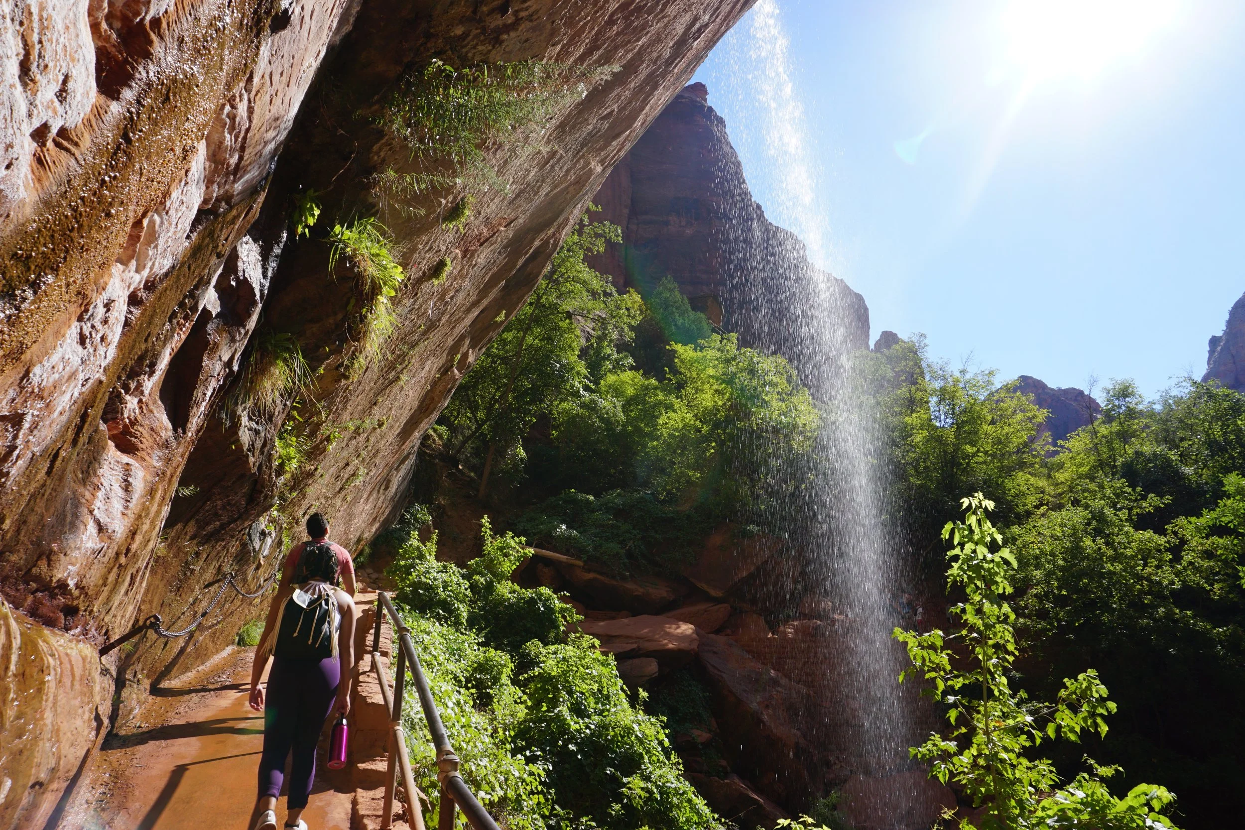
Zion | Emerald Pools Trail

Snow Canyon State Park
Yosemite National Park
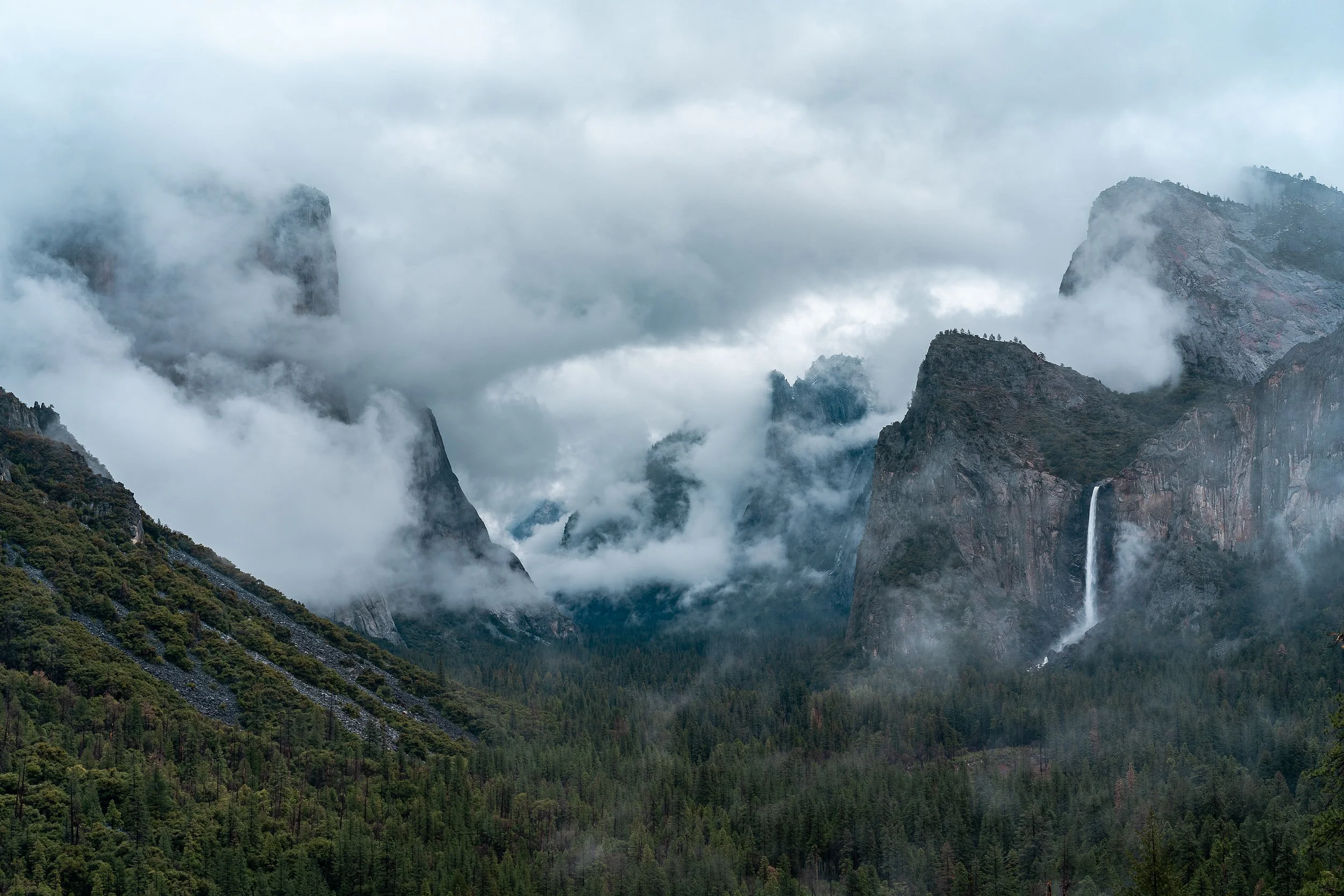
Yosemite Valley is a glacial valley in Yosemite National Park in the western Sierra Nevada mountains of Central California. Yosemite Valley is unlike anything I have personally ever experienced. From the moment you drive in - seeing El Capitan, the numerous waterfalls, and the granite cliffs - it is no wonder John Muir said “But no temple made with hands can compare with Yosemite. Every rock in its wall seems to glow with life”. I highly recommend you read John Muir’s 1912: The Yosemite and I hope you enjoy the galleries below.
Yosemite National Park is in California’s Sierra Nevada mountains. It’s famed for its giant, ancient sequoia trees, and for Tunnel View, the iconic vista of towering Bridalveil Fall and the granite cliffs of El Capitan and Half Dome. In Yosemite Village are shops, restaurants, lodging, the Yosemite Museum and the Ansel Adams Gallery, with prints of the photographer’s renowned black-and-white landscapes of the area.
Yosemite Valley
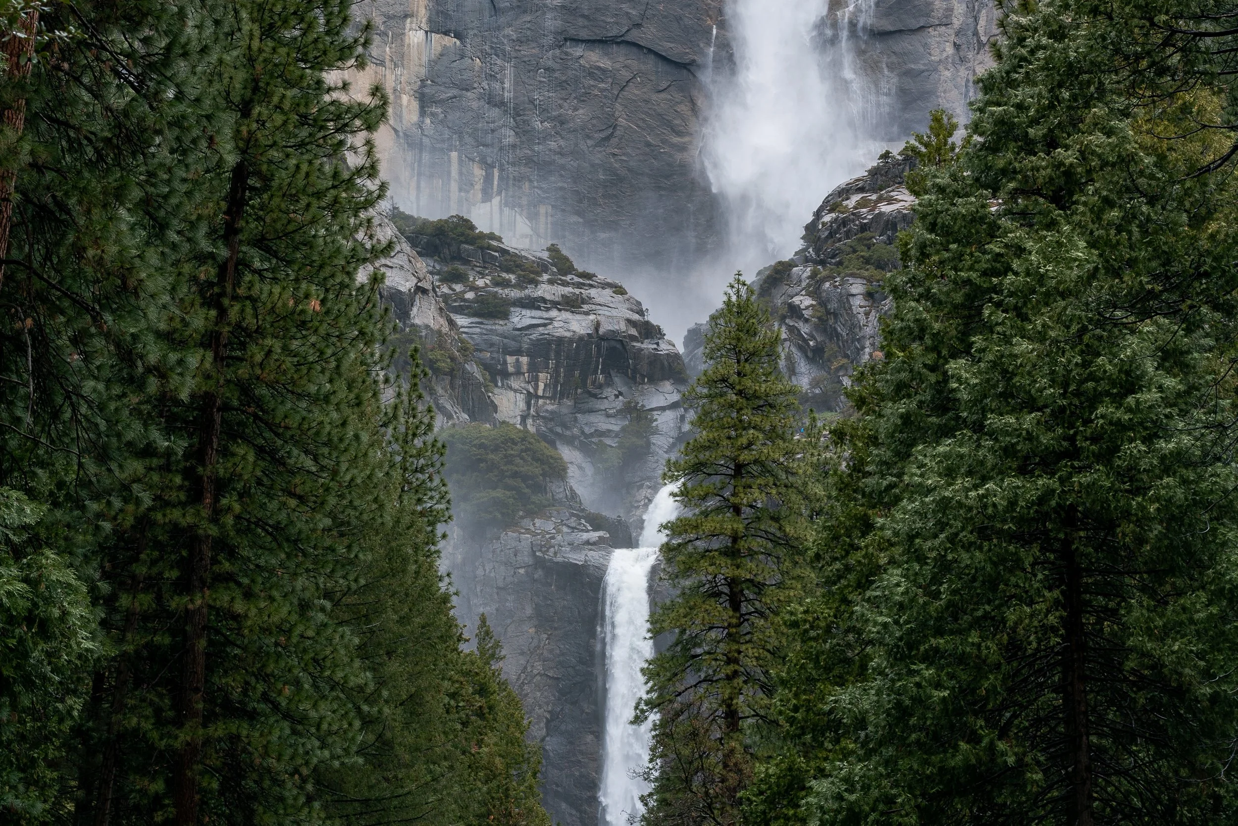
Lower Yosemite Falls

Wawona / Campground

Middle Gaylor Lake
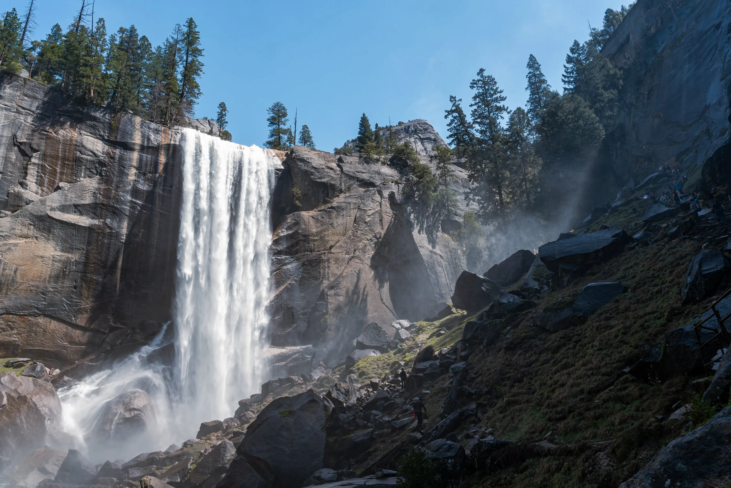
Vernal Fall
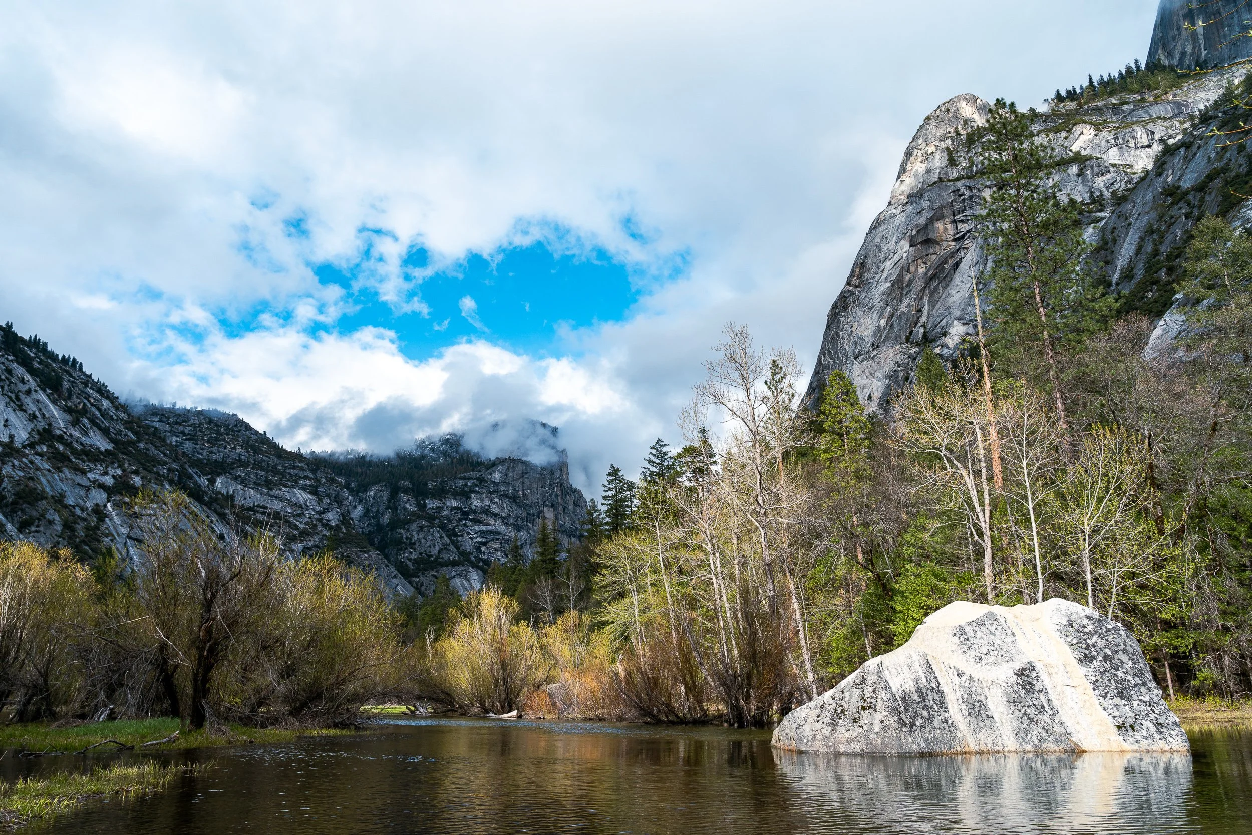
Mirror Lake

Wawona Swinging Bridge

Tuolumne Grove Trail

Nevada Fall

Mariposa Grove of Giant Sequoias

Tioga Pass Road
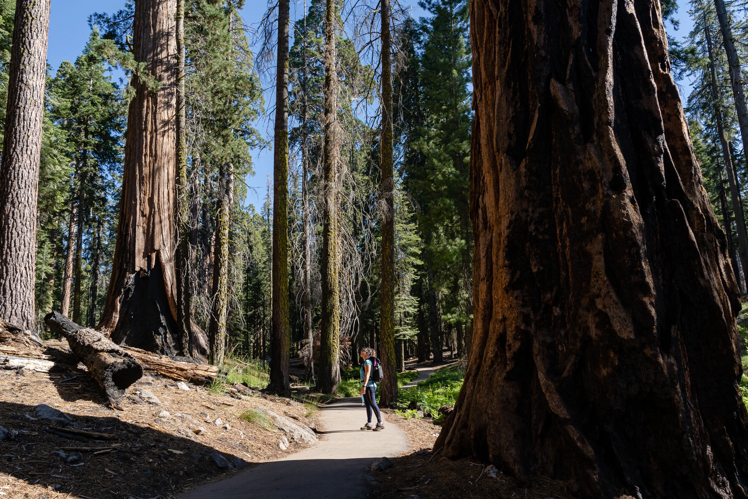
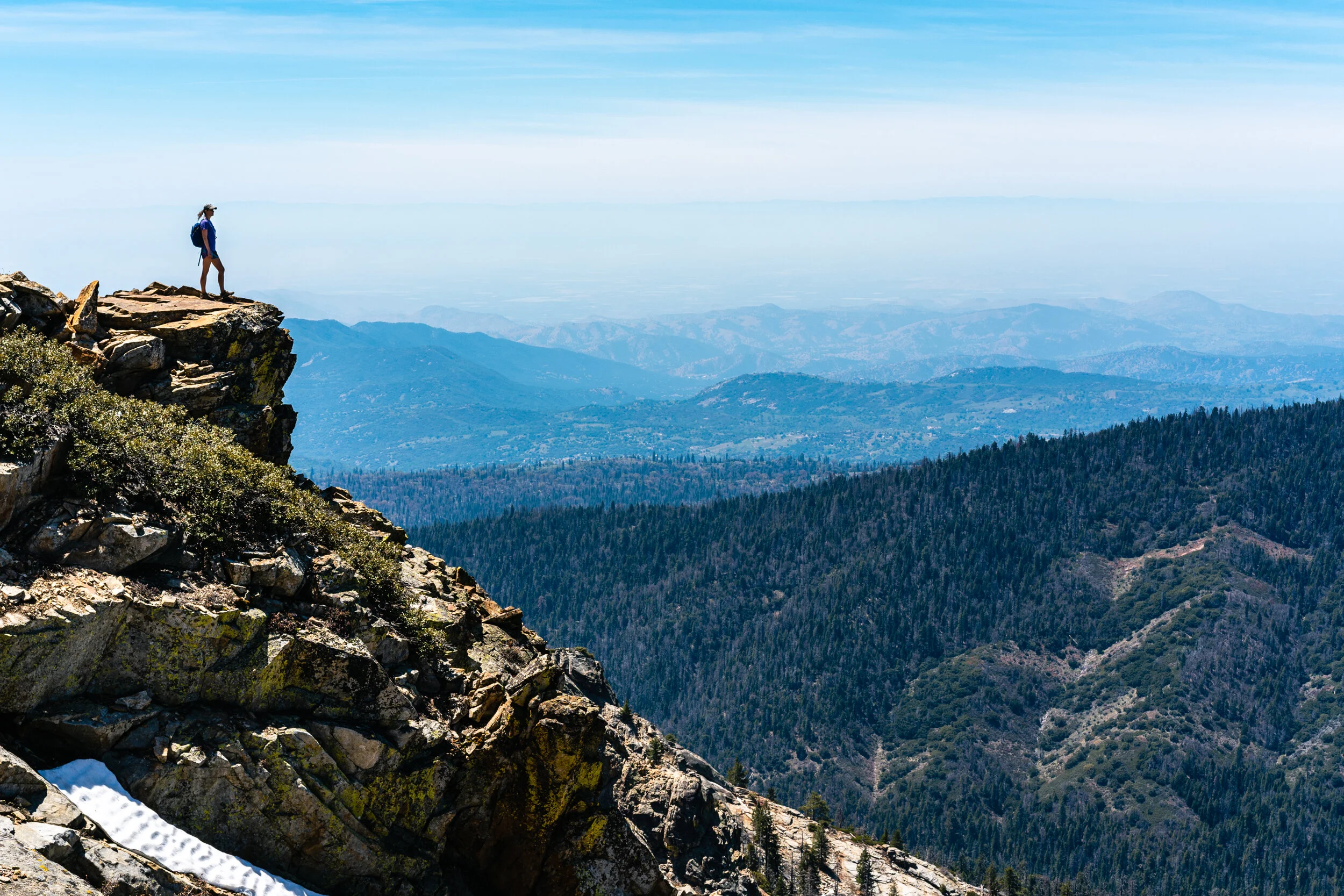
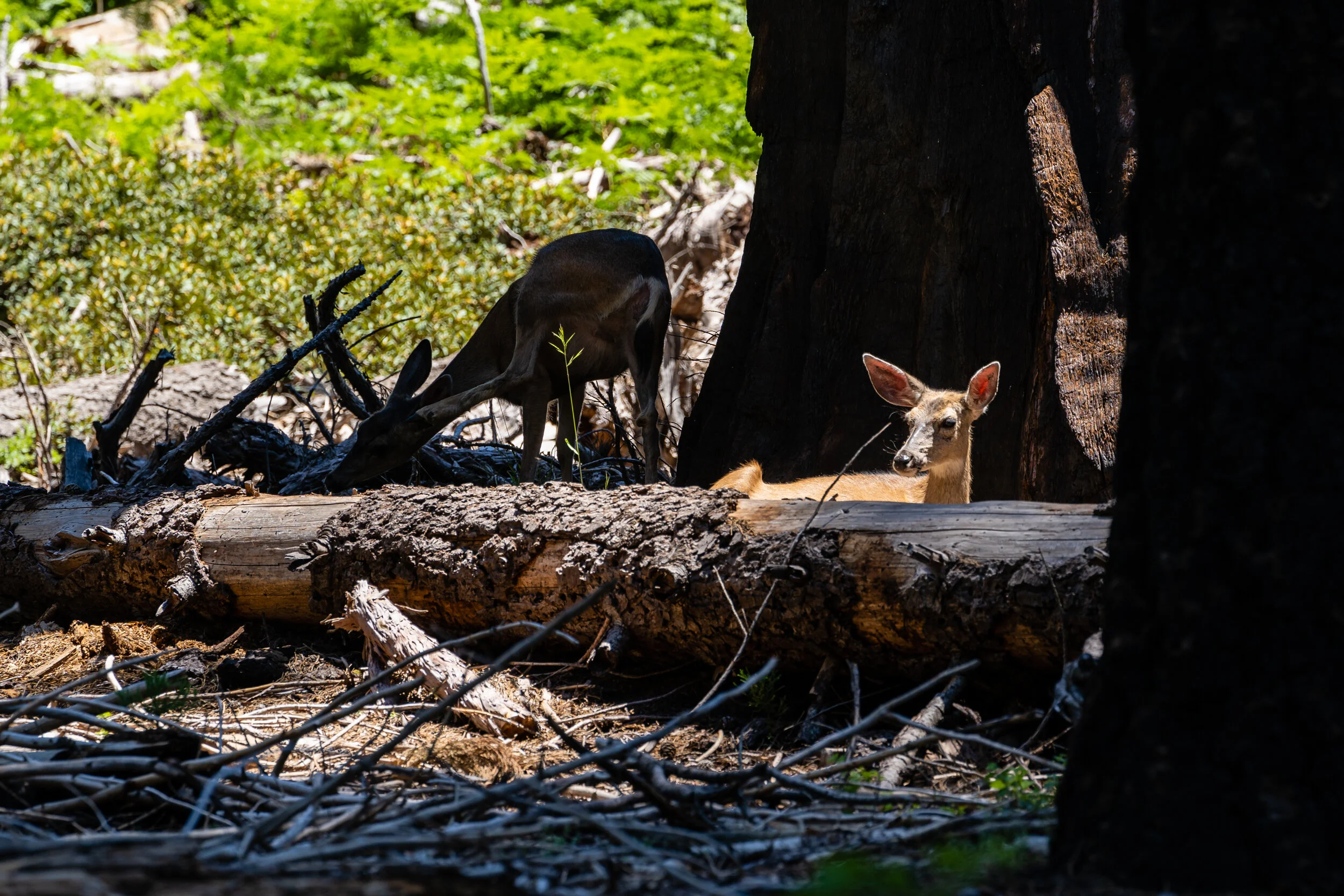
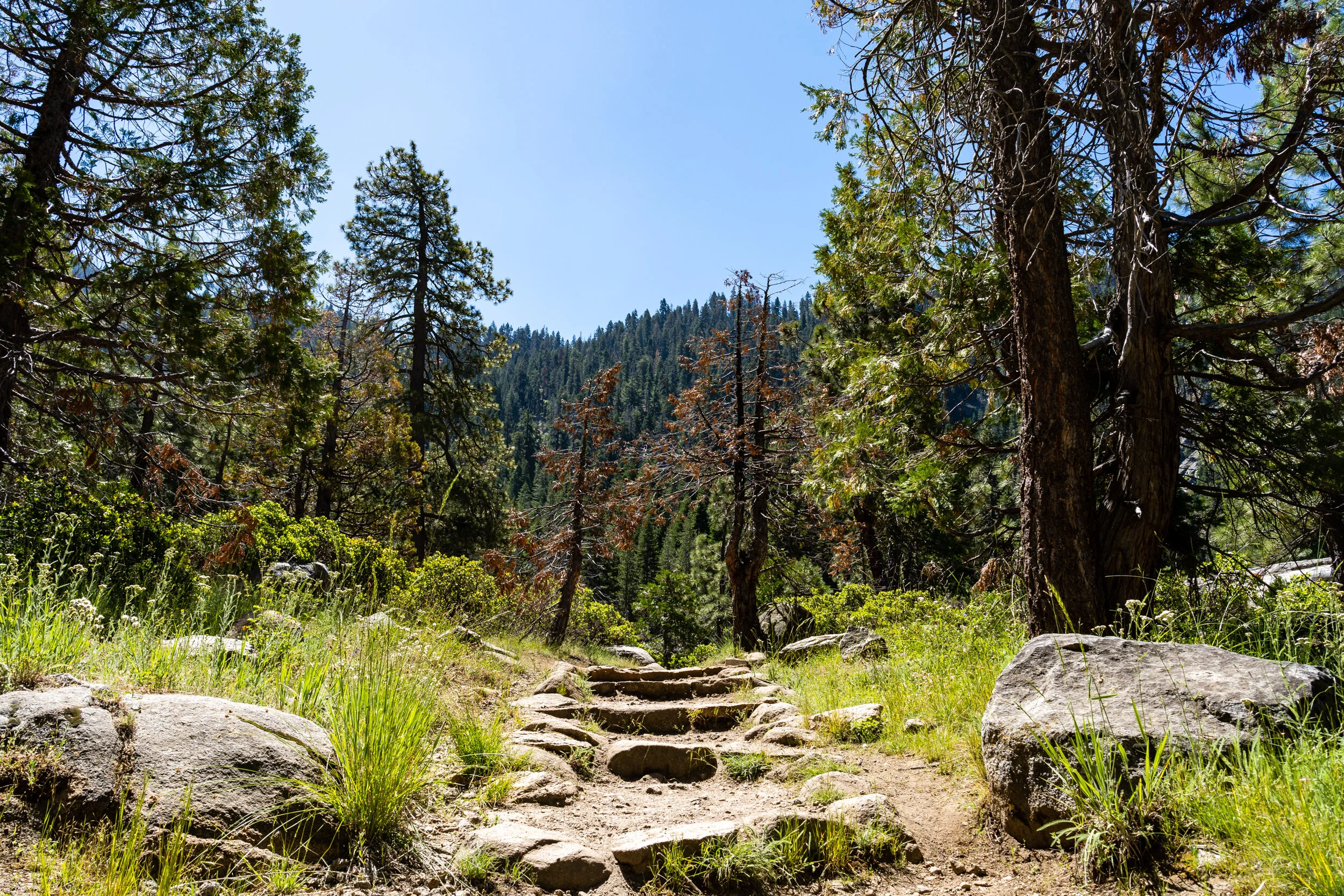
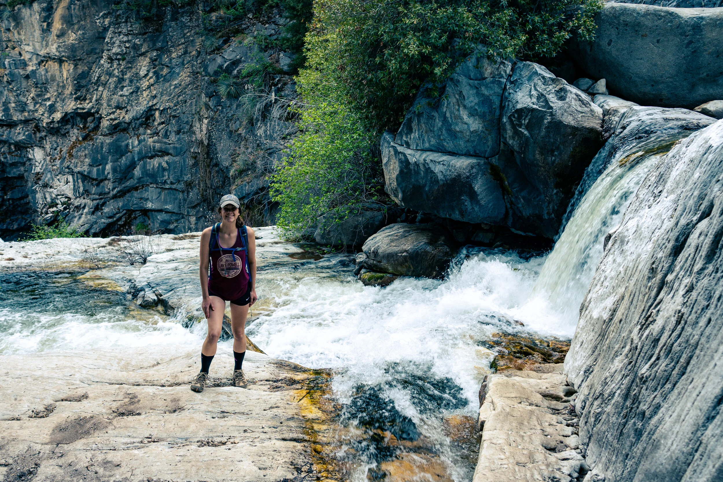
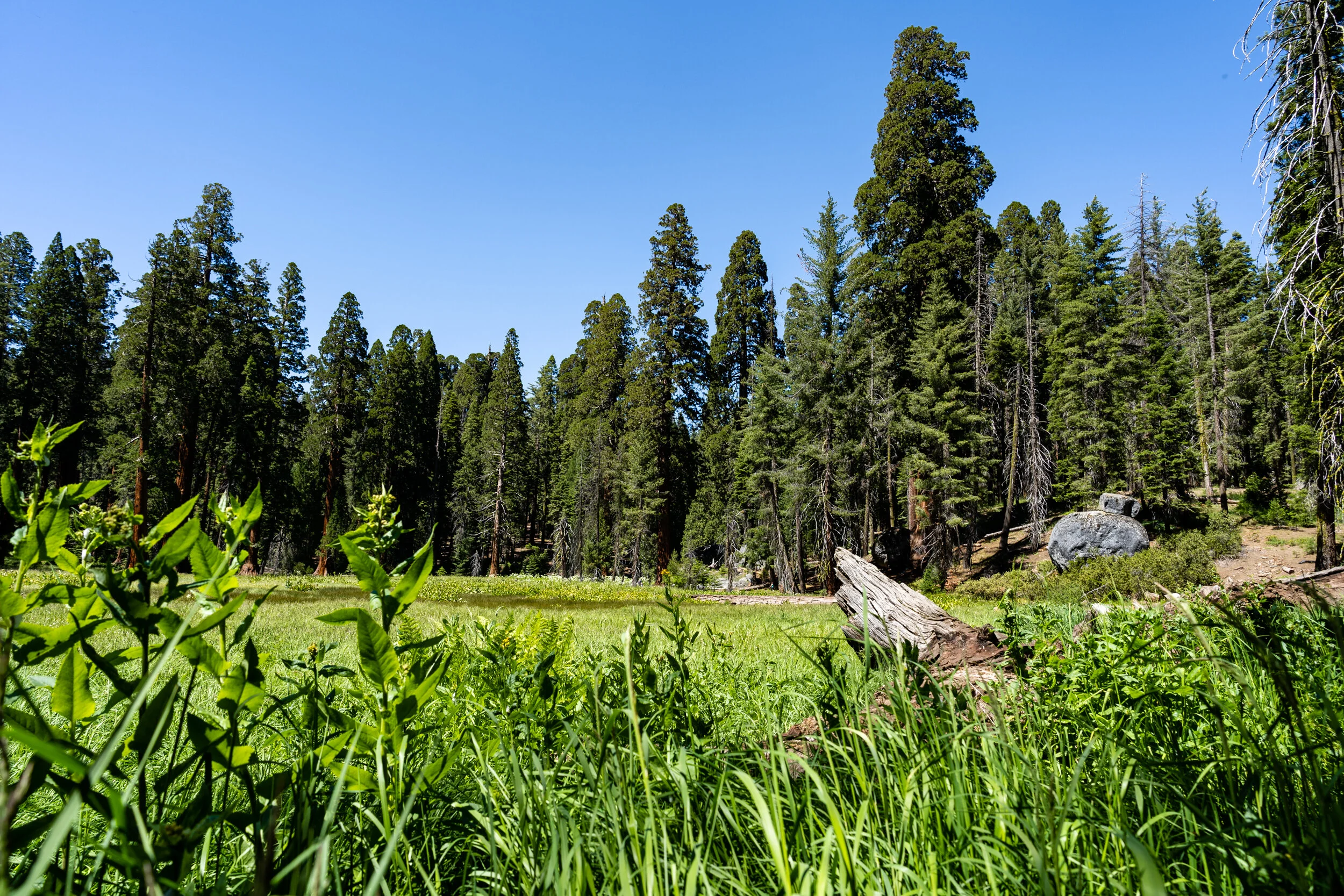
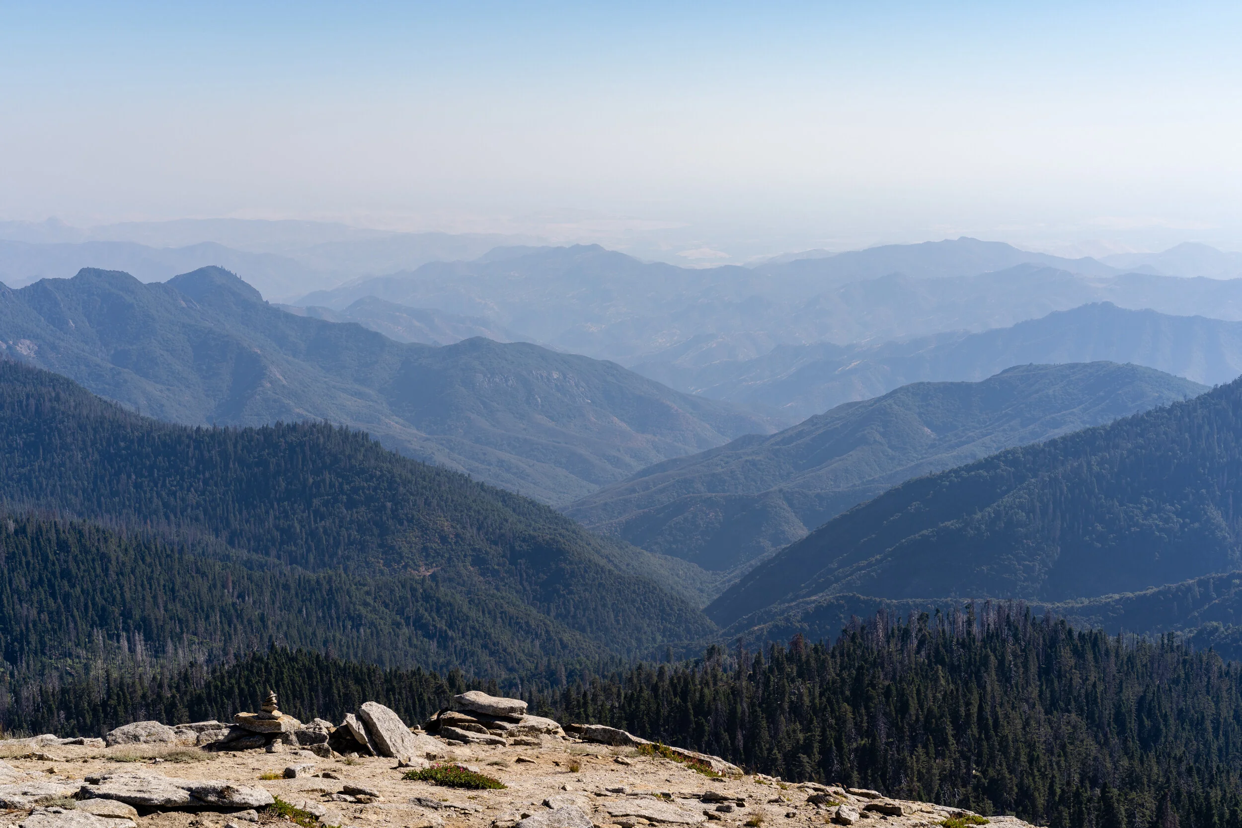
Sequoia & Kings Canyon National Parks
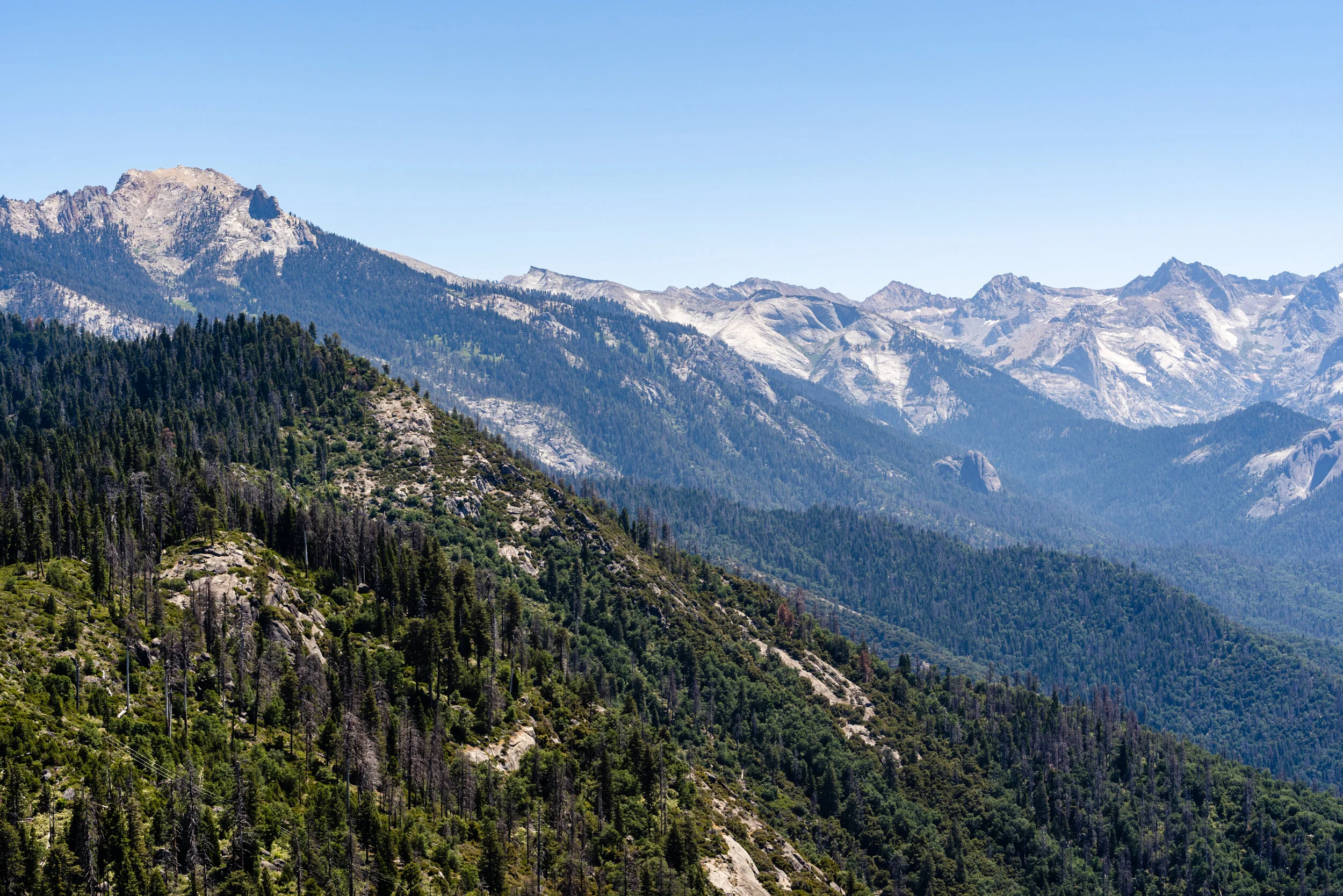
Sequoia & Kings Canyon National Park is covered by ancient forests, soaring domes, stone canyons, and rivers that roar or ripple, depending on the season.
Sequoia National Park was established in September 1890 and encompasses more than 631 square miles; Kings Canyon National Park was established 50 years later in 1940 and encompasses 722 square miles.
Sequoia National Park is named for earth’s largest living things – Sequoiadendron giganteum, or giant sequoias. Their massive, cinnamon-hued trunks and stout limbs soar skyward only here, on the western slope of the Sierra Nevada range, between 5,000 and 8,200 feet. (Taller and more slender, coast redwoods grow only on a narrow strip along the Pacific Coast.)
Kings Canyon National Park is named for the deepest canyon in North America, surpassing even the Grand Canyon. The Kings River and Highway 180 (coined the Kings Canyon Scenic Byway) run through it, descending 4,000 feet. Conifer forests give way to chaparral before the highway reaches desert-like terrain with scattered cacti and yucca. This is perhaps Kings Canyon’s most striking span, with jagged metamorphic rock walls closing in on the highway before the pines return at Roads End.
Moro Rock Trail
Congress Trail
Big Baldy Trail

Willow Meadow Via Twin lakes
Crescent Meadow Loop
Tokopah Falls Trail
Marble Falls

General Grant Trail
Big Trees Trail
Little Baldy Trail

Hospital Rock

Around Sequoia
Mammoth and The Sierra Nevada
I try to head out to Mammoth Mountain at least once a year. An absolutely beautiful town in the mountains.
Mammoth Mountain is a lava dome complex west of the town of Mammoth Lakes, California, in the Inyo National Forest of Madera and Mono Counties. It is home to a large ski area on the Mono County side.
There is so much to explore around Mammoth and in the Inyo National Forest. Stay tuned for more!

On the mountain

Around Mammoth
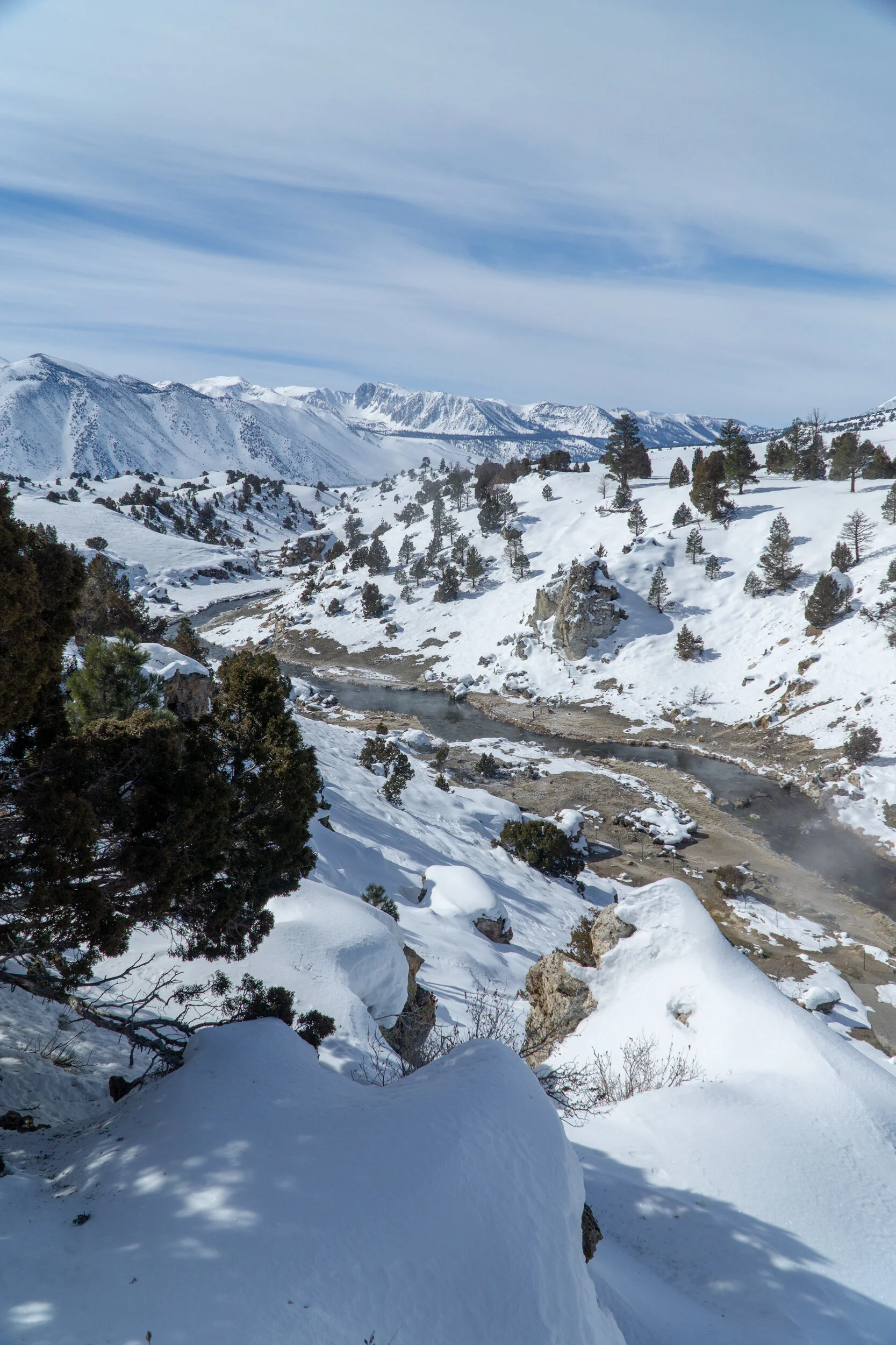
Hot Creek Geological Site

June Lake

Convict Lake
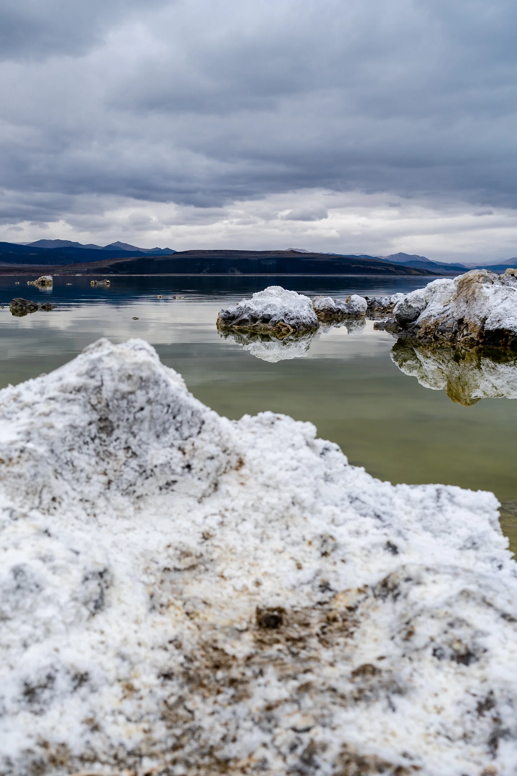
Mono Lake

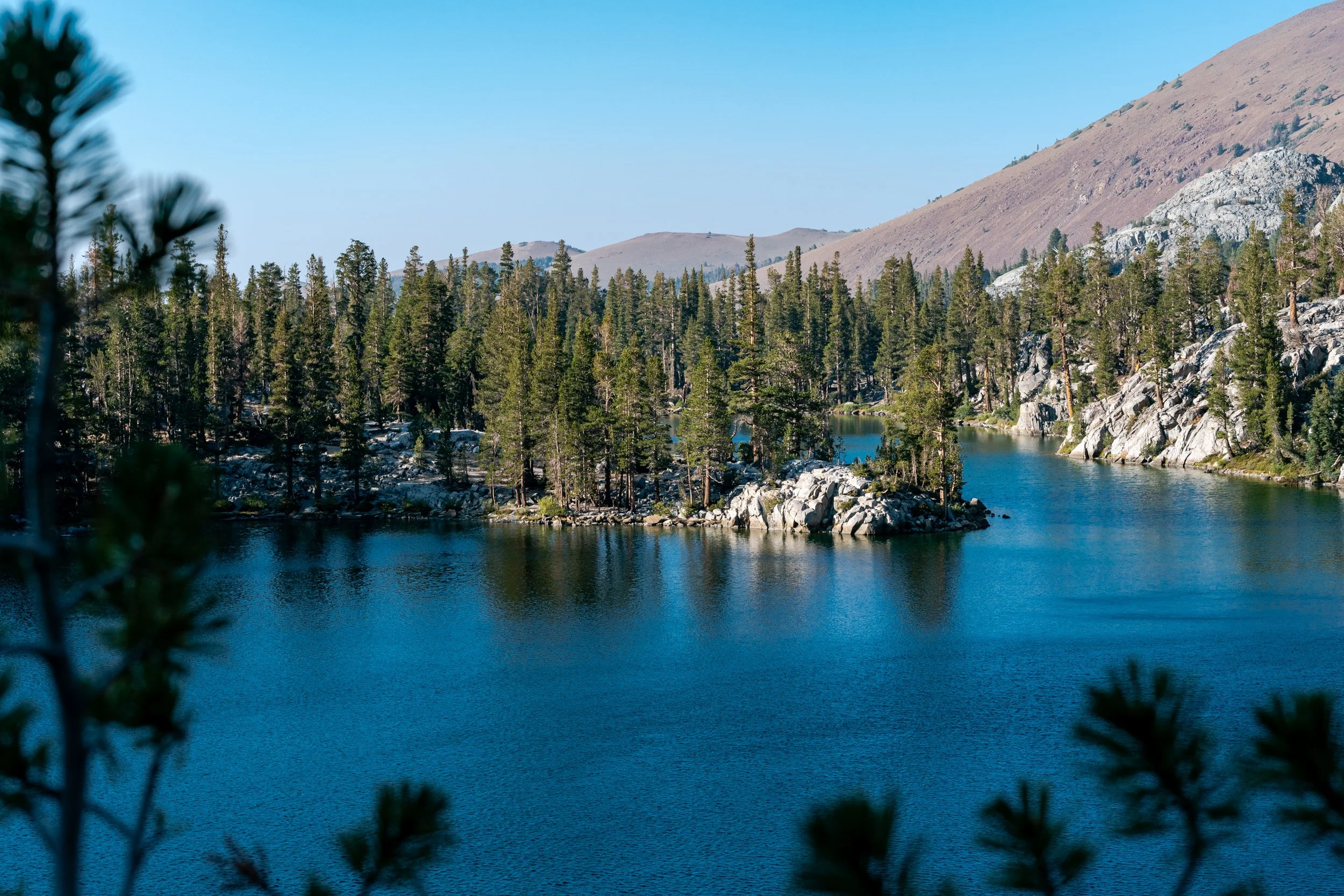
Emerald Lake
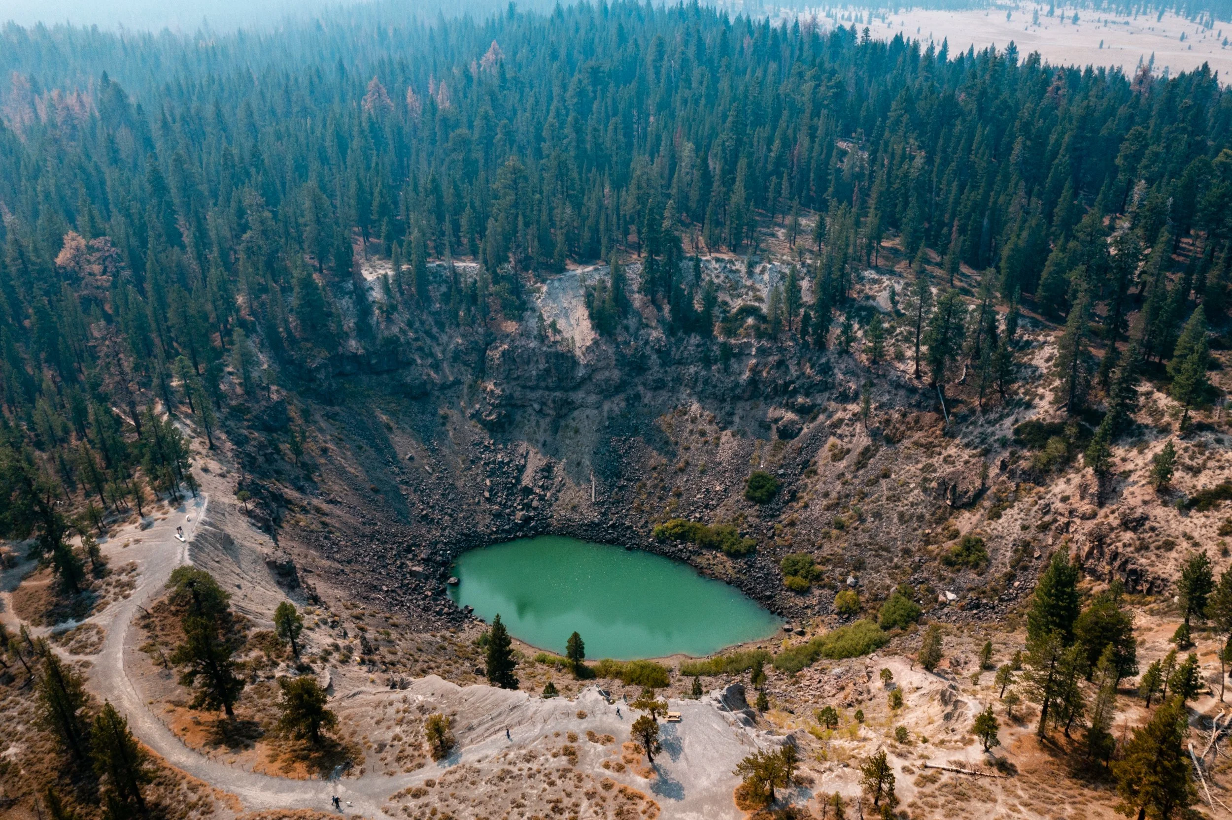
Inyo Craters
(Mammoth Scenic Loop)

Minaret Falls

Twin Lakes

Duck Lake
(Via Emerald, Skelton & Barney Lakes)

Devils Postpile

Rainbow Falls via Devils Postpile
Skelton Lake
(Via Duck Pass and Arrowhead Lake)

McCleod Lake

Crystal Lake

Nunatak Nature Trail

Lake Mary Loop

Old Shady Rest Campground

Coldwater Campground

Earthquake Fault Trail

Lake Mary Campground
Death Valley National Park
I was pleasantly surprised by the beauty of Death Valley National Park. While I was expecting a typical desert landscape similar to Joshua Tree, the park's diverse terrain and the vibrant colors that surround it were truly stunning.
Despite its ominous name, Death Valley teems with a wide variety of life. The park straddles the boundary between the arid Great Basin and Mojave deserts, safeguarding the northwest corner of the Mojave Desert along with its diverse ecosystem of salt flats, sand dunes, badlands, valleys, canyons, and mountains.

Dantes View

Twenty Mule Team Canyon

Zabriskie Point

Badwater Basin

Natural Bridge Canyon Trail

Devils Golfcouse
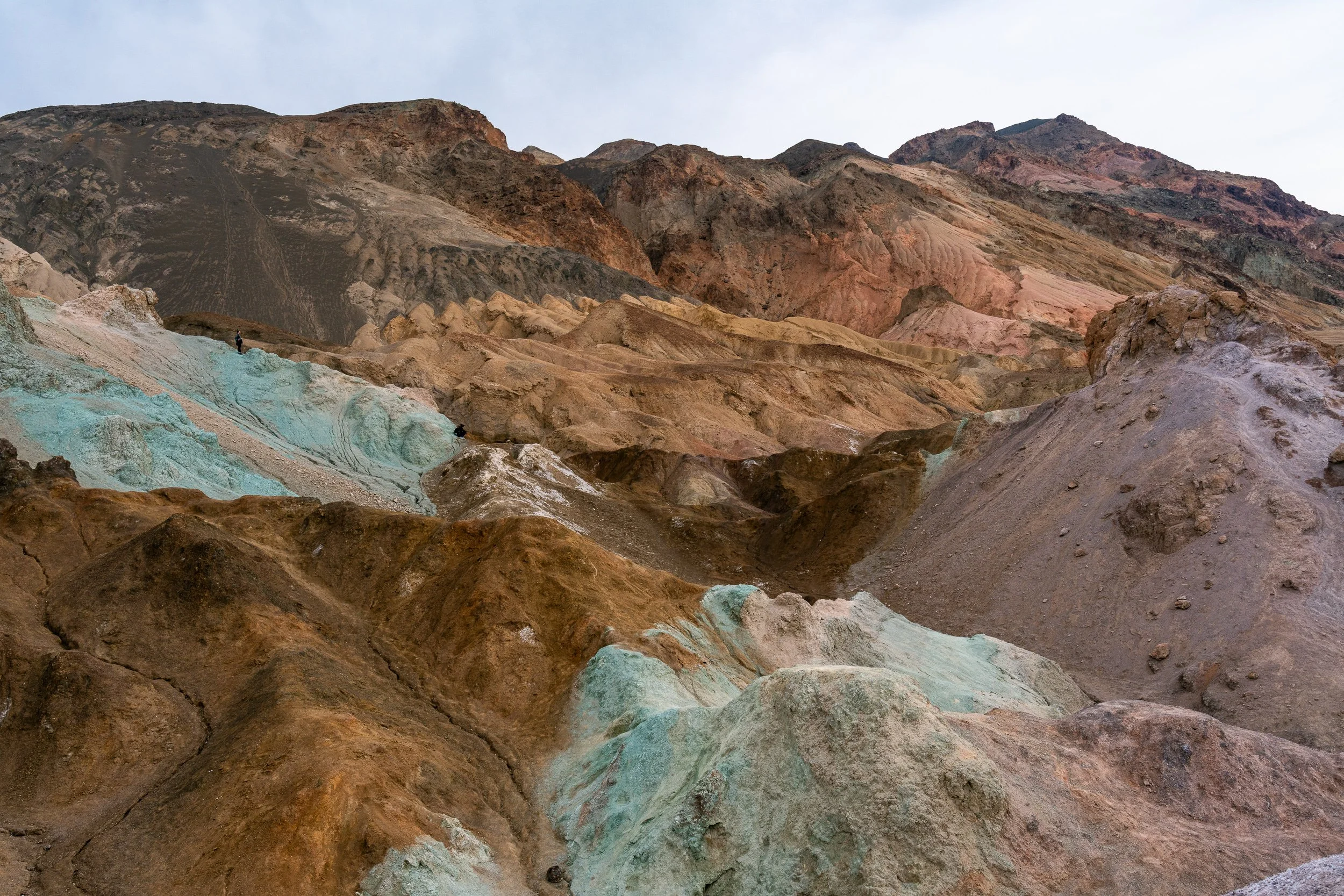
Artists Palette

Around Death Vallery

Golden Canyon to Red Cathedral

Mesquite Flat Sand Dunes
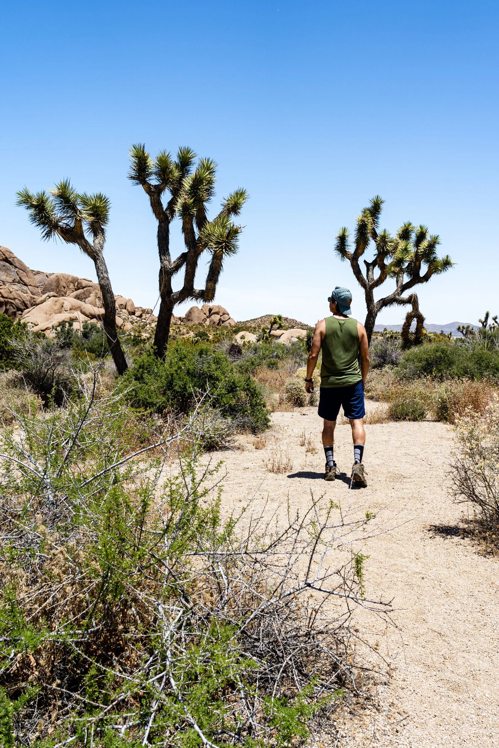
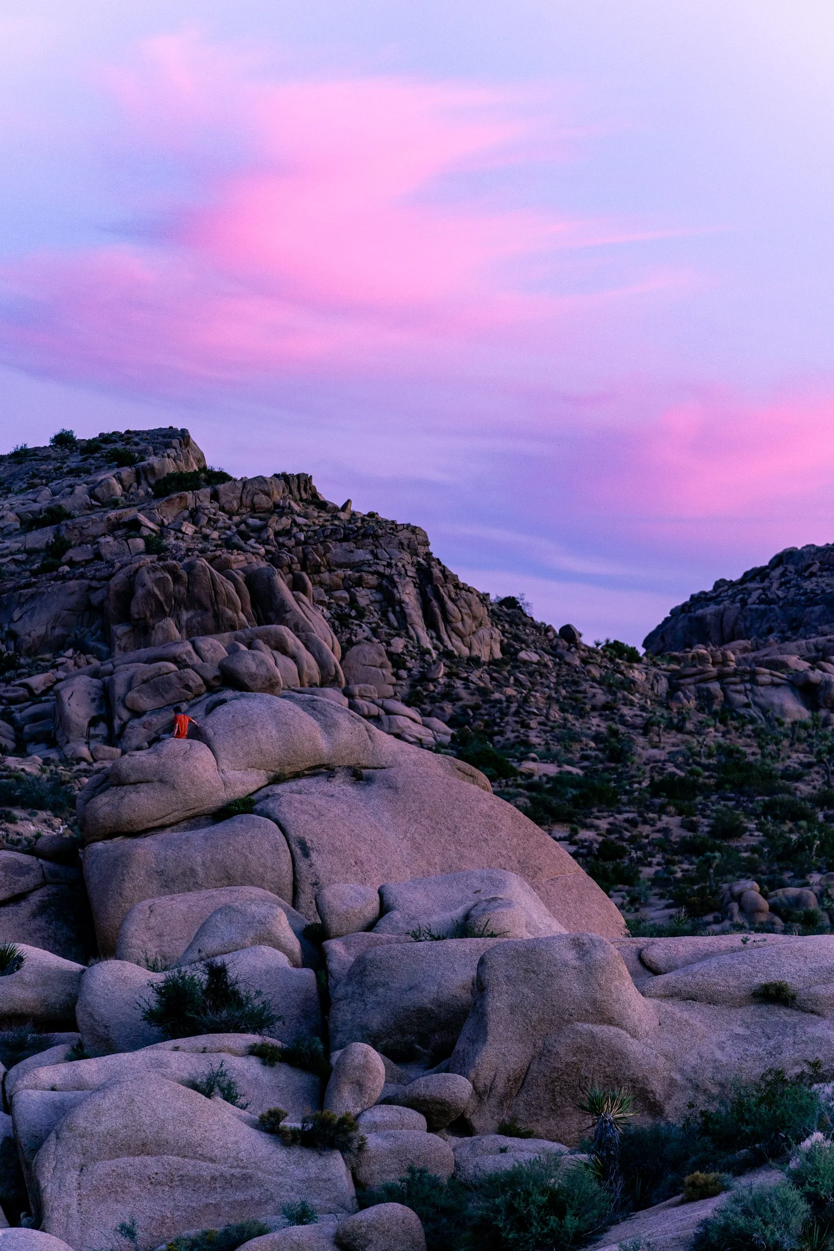
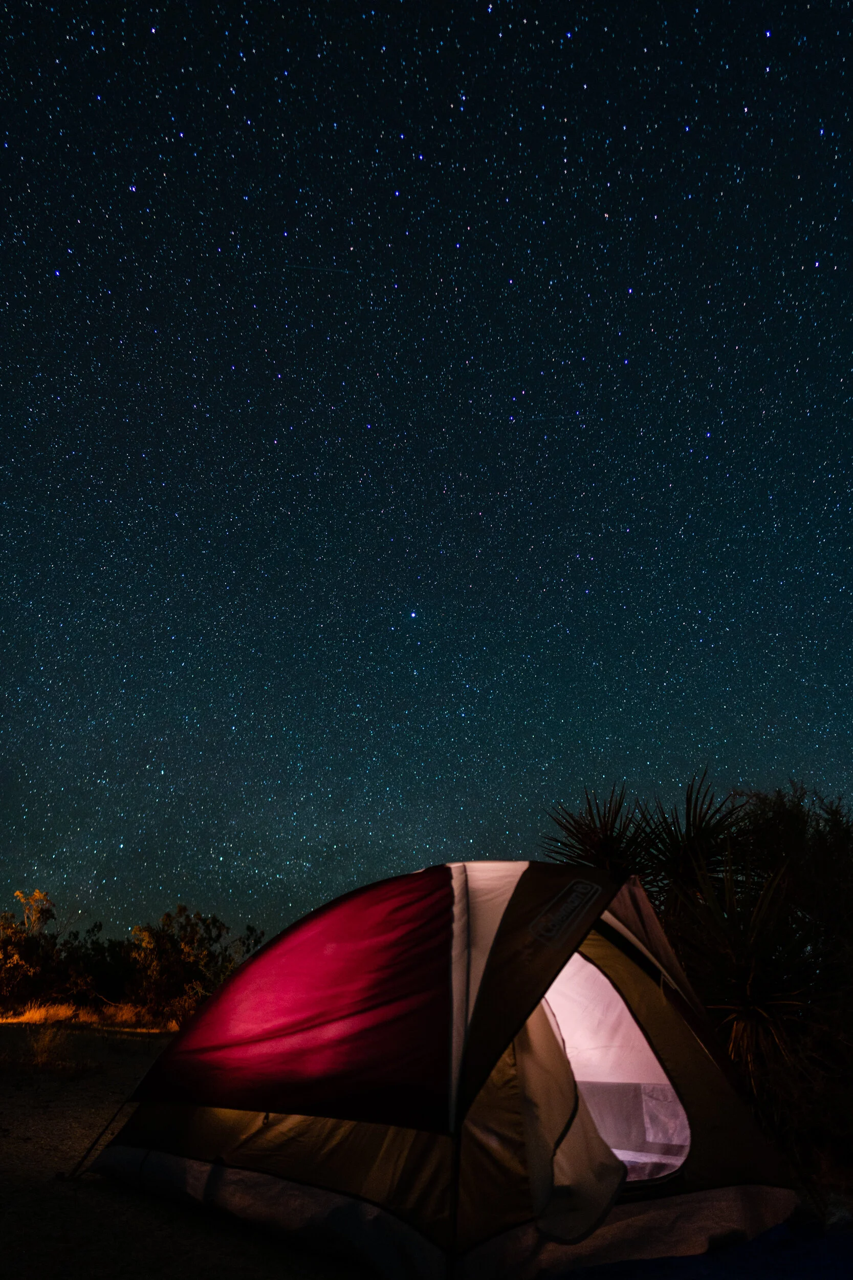
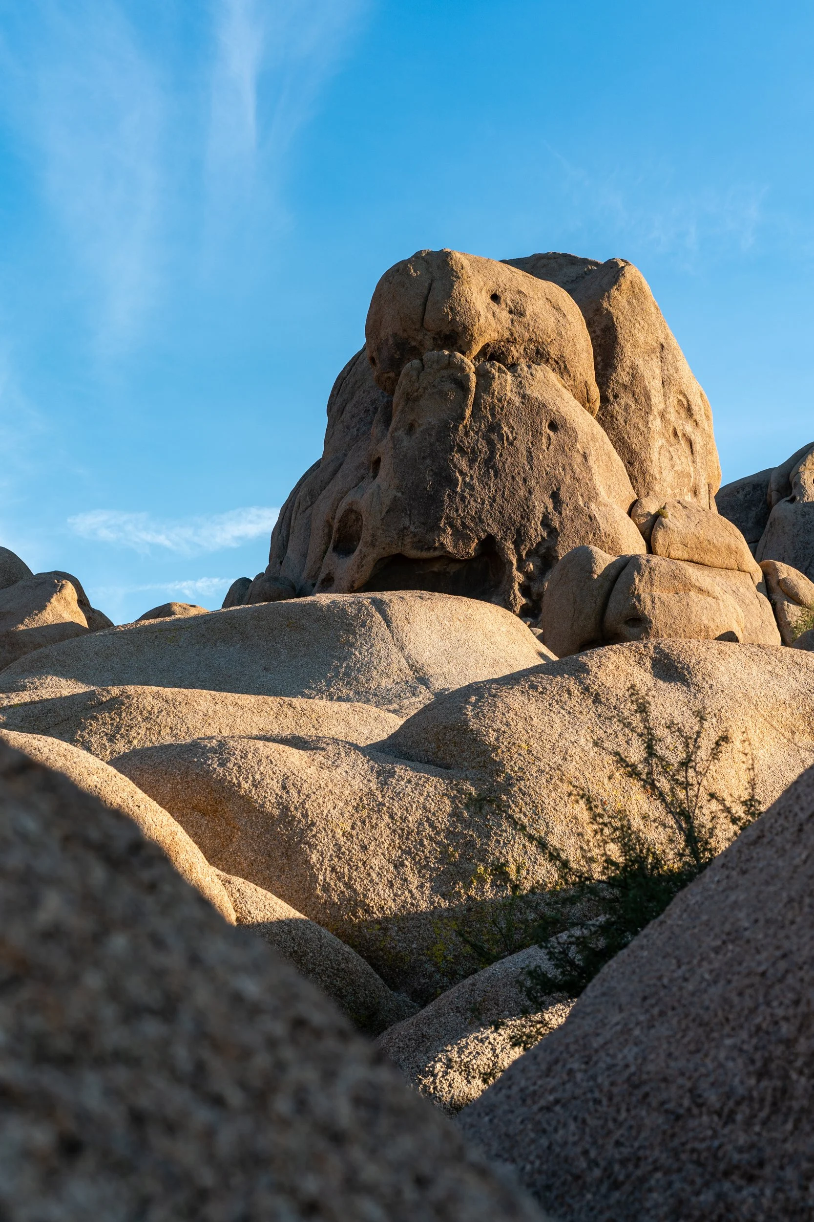
Joshua Tree National Park
Joshua Tree is our closest National Park. In one of my trail videos, I talk about Minerva Hoyt - without her leadership, Joshua Tree National Park might never have become part of the National Park System.
Joshua Tree National Park is a vast protected area in southern California. It's characterized by rugged rock formations and stark desert landscapes. Named for the region’s twisted, bristled Joshua trees, the park straddles the cactus-dotted Colorado Desert and the Mojave Desert, which is higher and cooler. Joshua Tree has a lot of really great trails - make sure you check out some of the camping and hiking galleries below.
Around Joshua Tree NP

Black Rock Canyon Trail
Jumbo Rocks Campground

Barker Dam Nature Trail
Cottonwood Campground
Skull Rock Trail

Lost Horse Mine Trail
Black Rock Campground

Ryan Campground
Grand Canyon National Park (South Rim)
“The Grand Canyon fills me with awe. It is beyond comparison—beyond description; absolutely unparalleled through-out the wide world ... Let this great wonder of nature remain as it now is. Do nothing to mar its grandeur, sublimity, and loveliness. You cannot improve on it. But you can keep it for your children, your children's children, and all who come after you, as the one great sight which every American should see” - President Theodore Roosevelt
Sharing my first-time experience visiting the awe-inspiring Grand Canyon. I'm including tips and tricks for planning your own trip to the Grand Canyon, including the best places to shoot photography, must-see viewpoints, and trails to check out first.

Mather Campground

Mather Point to Bright Angel Trailhead

Mather Point to South Kaibab Trailhead

Mather Point to Yaki Point


Pima Point to Hermits Rest
State Road 64
Hawaii
There are currently two galleries under the Hawaii section of this page - Maui and Haleakala National Park. I look forward to adding more!
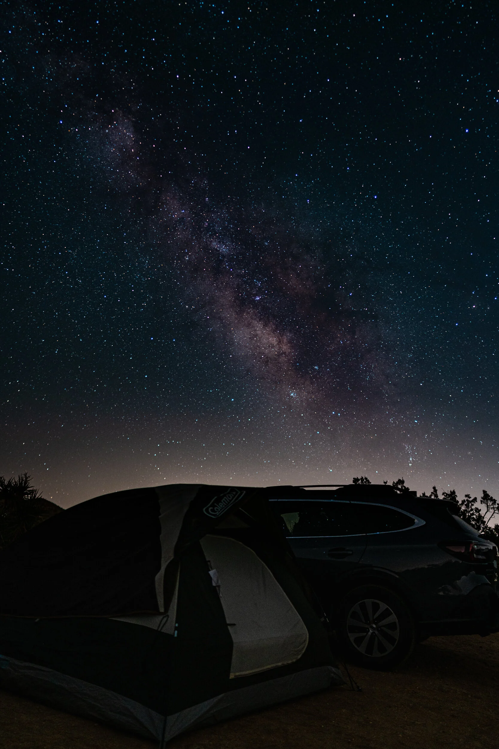
Towering over the island of Maui and visible from just about any point, Haleakala Crater is a force of nature in every sense. At 10,023 feet above sea level, this dormant volcano is the stage for a breathtaking range of landscapes—and skyscapes. Haleakala means "house of the sun" in Hawaiian, and legend goes that the demigod Maui lassoed the sun from its journey across the sky as he stood on the volcano’s summit, slowing its descent to make the day last longer.
Many visitors wake up early to drive to the Haleakala Visitor Center, the best spot to watch what may be the most spectacular sunrise on earth. As the sun peeks over the horizon, an ever-changing swirl of color and light dance across the vast sea of clouds—a sight described by Mark Twain as “the most sublime spectacle I have ever witnessed.” Perhaps just as impressive are Haleakala’s sunsets and the bright, starry skies revealed at night. Remember, the National Park Service now requires a reservation for personal and rental vehicles to view the sunrise from the summit district(link is external). Your reservation(link is external) is for parking at the summit and doesn’t include the required national Park entry fee. Drive times from Kaanapali and Wailea to reach the summit average 2 hours. (gohawaii.com source)

Maui

Haleakala National Park
Vancouver and Seattle
We spent an amazing week exploring Vancouver, Seattle, and the breathtaking Mount Rainier National Park. Check out our vlog for the full experience and click the links below to see photo galleries for each location.
Mount Rainier, an active stratovolcano, dominates the landscape with its 14,411 feet (4,392 meters) of majestic presence. It boasts an extensive network of hiking trails and offers breathtaking vistas of glaciers, wildflowers, and diverse wildlife, making it a haven for adventure seekers and photographers.

Around Vancouver

Granville Island

English bay - Stanley Park

Lynn Canyon

Capilano

Bainbridge and The Grand Forest

Around Seattle

Space Needle

Chihuly Garden

Around Mount Rainier

Narada Falls

Skyline and Alta Vista Trails
Puerto Vallarta, Mexico
Puerto Vallarta, situated on Mexico's Pacific coast in the state of Jalisco, is a place of exceptional beauty. With its golden beaches set against the backdrop of the majestic Sierra Madre Mountains, it offers a captivating blend of natural splendor and cultural charm. The village of Mismaloya, just a short drive away, boasts a serene beach and lush jungle surroundings, while the nearby Los Arcos archipelago provides an underwater paradise for snorkeling and diving enthusiasts. Puerto Vallarta's romantic old town, known as "Zona Romántica," with its cobblestone streets and vibrant art scene, adds to the city's allure, making it a must-visit destination for those seeking a harmonious blend of nature and culture.

Puerto Vallarta
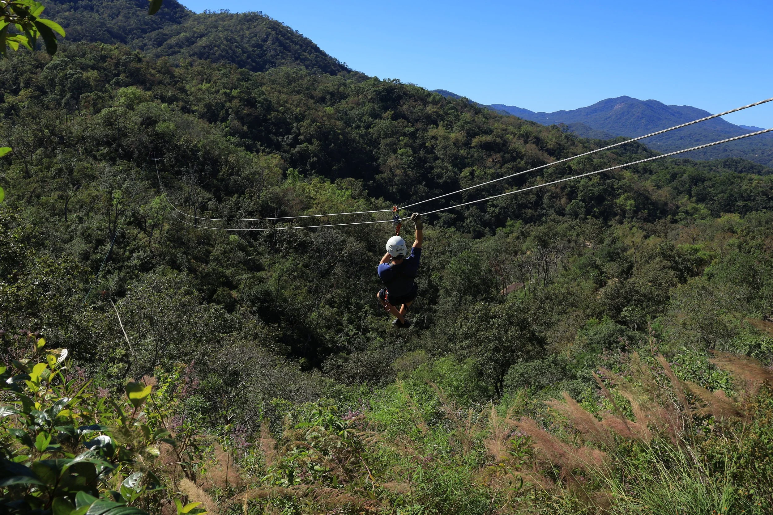
Vallarta Adventures